|
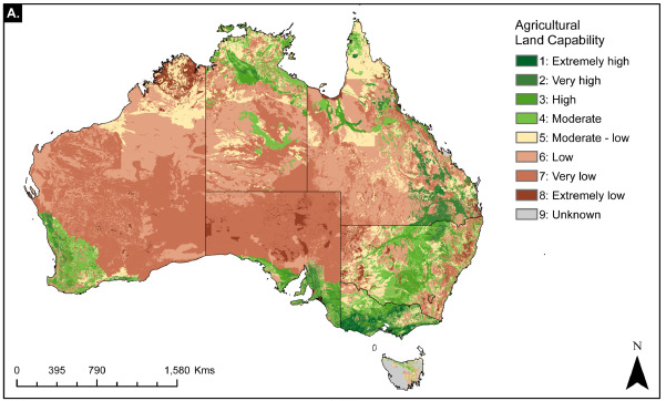
Agricultural capability map of Australia.
Citation: Adams, VM. & Engert, JE. (2022). Australian agricultural resources: A national scale land capability map. Data in Brief, 108852. This file contains a national agricultural land capability map for Australia, based on state agricultural land capability datasets reclassified to a single agricultural land capability classification (NSW method) and modeled grazing suitability. |
|
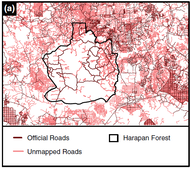
Roads within the Harapan Rainforest (Hutan Harapan) and surrounding area.
Citation: Engert, JE., Ishida, FY. & Laurance, WF. (2021). Re-routing a major Indonesian mining road to spare nature and reduce development costs. Conservation Science and Practice, e521. This file includes all official roads (from Indonesian Government road maps for 2016, obtained through Badan Pusat Statistik) and mapped roads (digitised from Google Earth imagery during the production of Engert, Ishida & Laurance, 2021) within the Hutan Harapan in Sumatra, Indonesia. |
|
[R function] Box-Cox transform rasters.
As outlined in this ResearchGate post. This file contains an R function that can be used to conduct Box-Cox transformations on raster datasets in R by getting the raster value table and using it to calculate the optimal lambda value. |


